
It was brilliant to have Mark and his drone back to capture (from the air) our progress on the project site. Here (below) are some of the shots – if you want to see the ‘before’ shots, they are here.
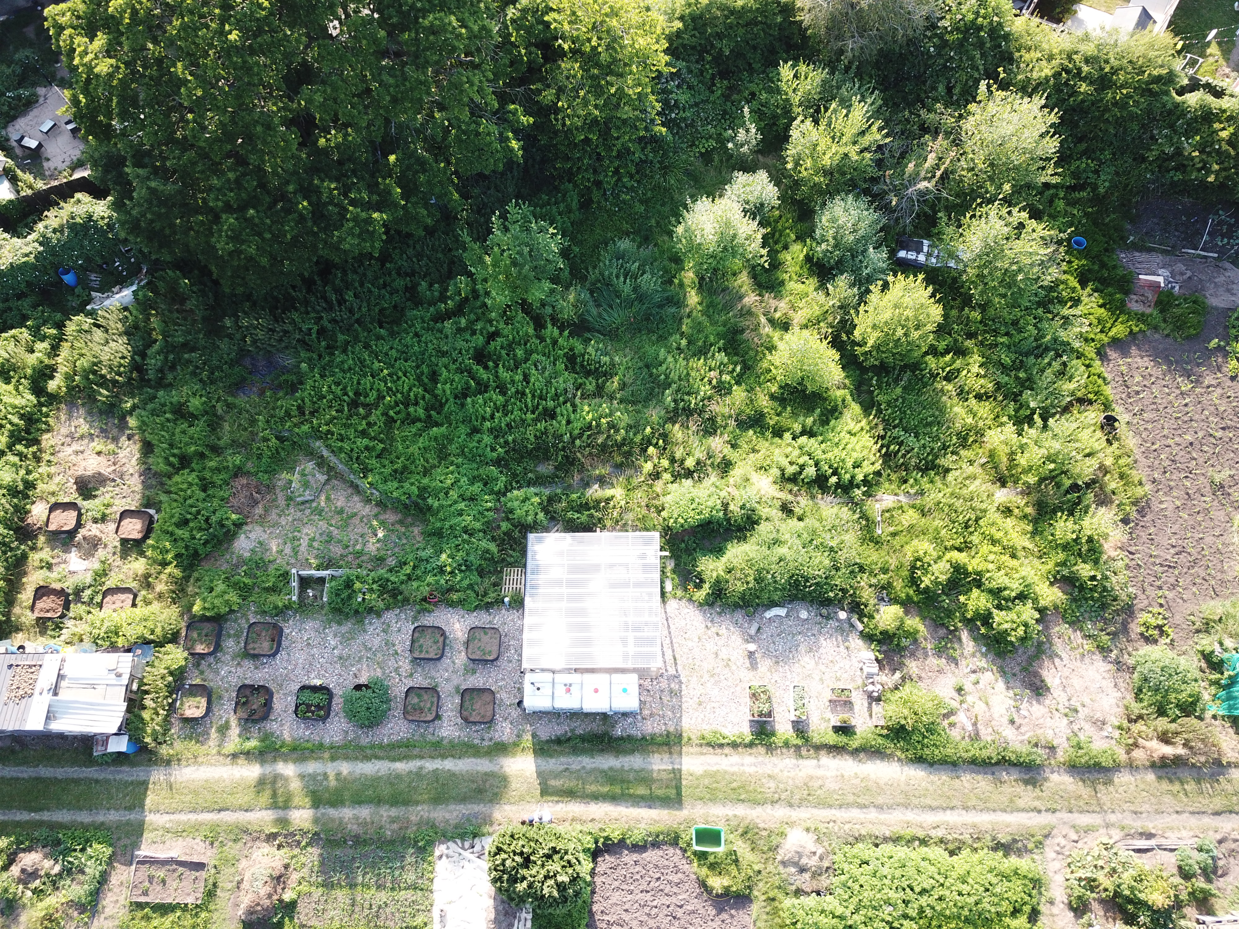
Here we are looking across the main access path (double lines towards the bottom of the image) and above that the hard-standing with shared learning/social space (pergola) in the centre. The four rainwater collection tanks can be seen between the shelter and the path, and the raised beds on either side. The mini food forest areas are the more open areas (because the trees are still saplings) towards the bottom right of the image, and the triangular cleared section towards the centre left – the top edge of this triangle is one of the dead hedges. The top half of the image shows the nature reserve, with the young wet willow woodland on the right and the ancient oak canopy top left.
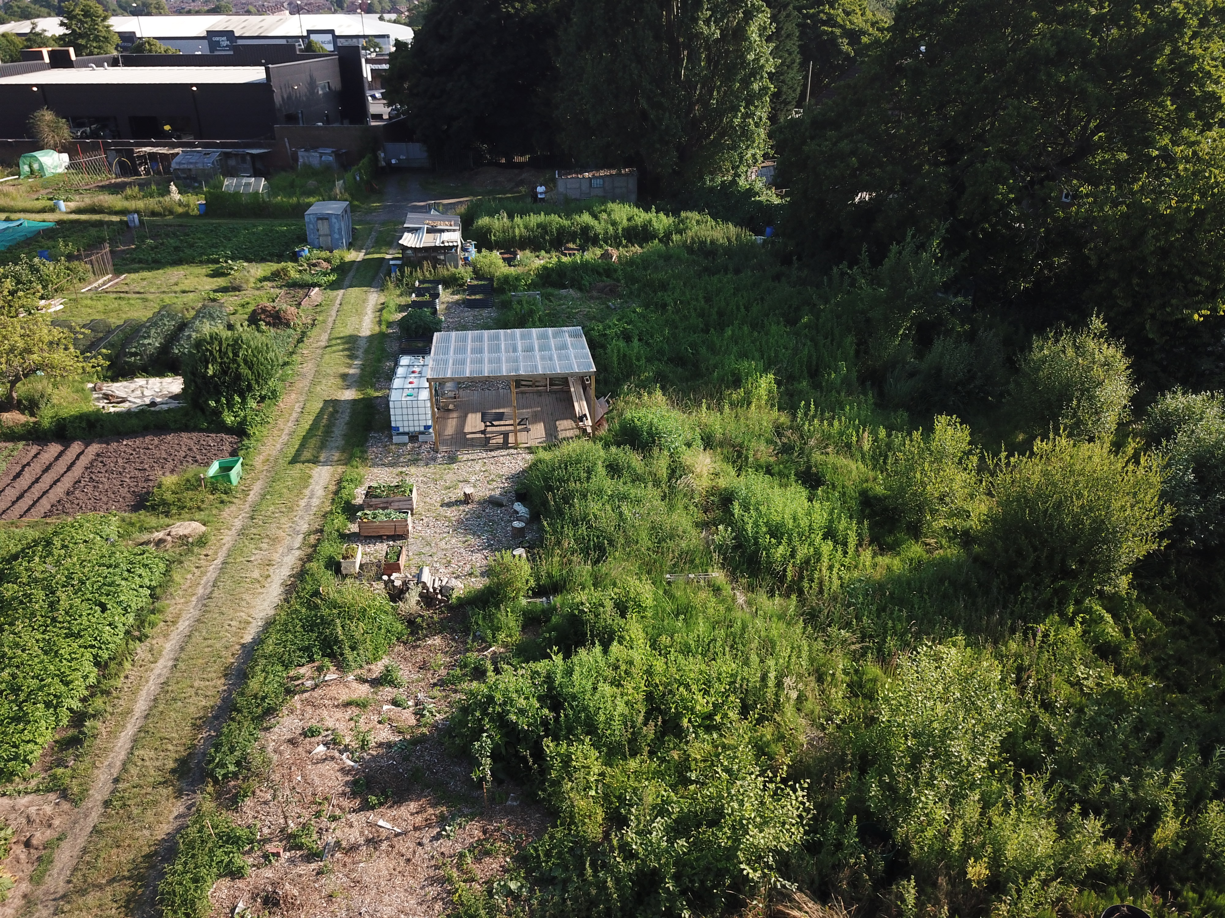
Here we are facing south, with the growing areas to the centre-left and the nature reserve to the right – with the learning/social shelter bang in the middle (water collection tanks to the left of it).
